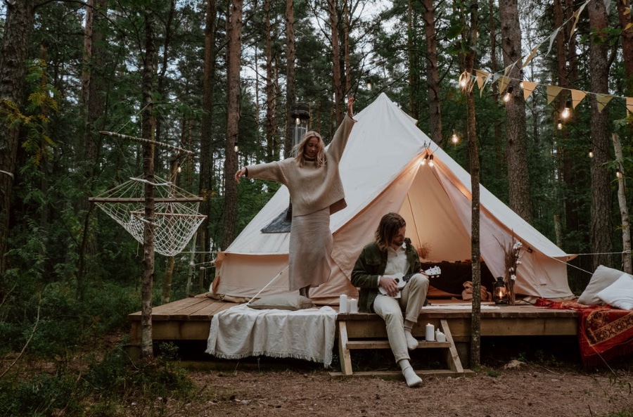
Here in Melbourne, they are fortunate to have access to some of the most beautiful trekking in all of Australia. And hiking is popular in Australia all through the year, so it's always a good time to trade in the pavement for a dirt path.
There is no shortage of oceanside paths, inland waterfalls, or mountainous landscapes in Victoria. These hikes are versatile enough to accommodate any whim or amount of time, whether you want to stop for a dip, take a leisurely half-day stroll, or spend the weekend trudging up a mountain. We've compiled a list of seven excellent day walks in the Melbourne area. It's high time you started crossing people off your list.
Day Hike Spot
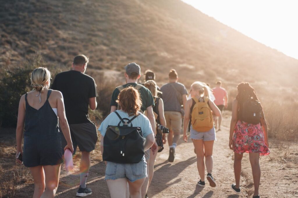
Prepare to explore some of the beautiful hikes within a short drive of Melbourne by putting on your hiking boots, packing your scroggin, and filling your Camelbak.
There are several beautiful hikes in regional Victoria that are perfect for getting your heart rate up, such as the ones through the temperate rainforest or along the coast.
You Yangs Regional Park
A dog is welcome! Between Melbourne and Geelong, you'll find the dog friendly You Yangs National Park. Flinders Peak Hike, a 3.2-kilometer journey to the You Yangs' highest point, is the greatest walk to try (with your puppy).
There are roughly 450 steps and an elevation gain of about 200 metres; you'll be huffing and puffing by the time you reach the summit, but you'll feel like a real champion when you do. The walk's beginning and ending points are both located at the parking lot off of Turntable Drive.
Alpine National Park's Mount Feathertop Via The Razorback Trail
In Alpine National Park, the 22-kilometre-long Razorback Trail leads up to Mount Feathertop, and it is not for the faint of heart or on windy days. However, the dedication and effort required to complete this trek are more than compensated for by the breathtaking panoramas that await you at the top. Wear your hiking boots, bring plenty of drink, and protect yourself from the sun.
There is a campsite halfway up the mountain if you'd rather take your time hiking up. The park is more than five hours' drive north-east of Melbourne, so even if you plan to trek the entire trail in a single day, you'll still need to spend the night nearby. You can easily spend the night in a comfortable cabin in Mount Hotham, Harrietville, Dinner Plain, or Bright.
Bushrangers Bay Trail
These coastal cliffs provide stunning views of Bass Strait during a stroll. Starting from the Cape Schanck parking lot, the trail travels across sandy outcrops, cultivated fields, and banksia woodland. Keep your eyes peeled for whales, chirping birds, and maybe even a kangaroo bouncing across the open fields. Take a refreshing swim at the trail's eponymous beach at the end of your hike.
Grampians National Park, Mount Rosea Walk
The Grampians are one of Victoria's most impressive mountain ranges, and they're also the site of a truly epic multi-day trek. The Mount Rosea Walk may be completed in four to five hours, making it a good option if you're short on time.
There is no apparent road, so you'll have to look for signs, and the trail includes some rock scrambling to keep things interesting. Along the route, you'll also reach a high-altitude suspension bridge. The unpaved roads leading to the trailhead are best navigated with a vehicle capable of high ground clearance. Those who aren't afraid of a little risk should take this path. It's about a three-hour journey to this national park, but there are lots of hotels and campers nearby if you want to spend the night.
Steavenson Falls
This trail's starting point is conveniently located near one of the state's highest (and most impressive) waterfalls: Steavenson Falls. And then, after crossing the De La Rue lookout, you'll start your ascent on a difficult dirt trail directed towards the Keppel Lookout.
You should come prepared with plenty of drink, snacks, and strong shoes because the trail has several hills and can be very treacherous after a rain. When the weather is fine, you can see all the way to the Cathedral Ranges from the Keppel Lookout, which is located halfway through the hike. Finally, start your descent back towards Falls Road. You can add on a stroll through the fern gully if you're feeling particularly energetic.
The Auski crew highly recommends the strenuous journey to Steavenson Falls to view Victoria's tallest waterfall (an 84-metre drop). The falls are approximately 350 metres from the parking lot, so even if you don't feel like hiking, you can still see them.
Beginning at the parking area for Steavenson Falls on Falls Rd, hikers can take in views of the stunning cascade before making their way through a mountain ash and stringybark forest to four spectacular vantage points overlooking Cathedral Range State Park, Steavenson Falls, and Marysville. You should bring plenty of water and snacks with you on this climb because the terrain may get steep in spots, is somewhat uneven, and is affected by the weather (slippery and muddy after rain).
Werribee Gorge Circuit Walk
This trail checks off three essential hiking boxes: stunning scenery, exciting rock scrambling, and, depending on the time of year, a refreshing swimming hole at the conclusion. The trail begins at the Meikles Point parking area and winds its way around the river and up the rocky summit from there. The best view of the park's natural attractions can be had from the Eastern Lookout, located on the gorge's edge.
Werribee Gorge State Park is approximately an hour from the Central Business District, making it an ideal destination for those seeking a trek that yet allows them to return home in time for lunch. The primary loop begins at the Quarry Car Park and travels around the gorge's rim and back down to its base.
Werribee Gorge has been formed over the course of 500 million years of geological history, which explains why the massive rock cliffs on either side make you feel like you're in Jurassic Park. It takes around three hours to complete the main circuit, which is eight kilometres long and well-marked. But there is a lot of rock scrambling on this hike, so don't do it after a downpour.
Great Otway National Park's Currawong Falls Track
You can reach Melbourne's bustling centre from the tranquil village of Aireys Inlet in just 90 minutes. Located so close to the beach and the Otways, this region is ideal for walkers, and we recommend the path that follows Ironbark Gorge to Currawong Falls. Starting from the Distillery Picnic Area, this route covers a distance of 10.2 kilometres and should take approximately 3.4 hours to complete.
From here, you can embark on a number of different trails, so read the signs carefully to ensure you don't end up lost. You'll see wallabies in the melaleuca swamp, walk through heathlands carpeted with tree ferns, and admire spring wildflowers in the Ironbark Forest. There are also ancient flowering grass trees scattered along the path. When you reach the peak, you'll be treated to breathtaking views, including a clear lookout of the Split Point Lighthouse.
Organ Pipes National Park
How peculiar is the natural world? A stunning national park about Twenty kilometres north of Melbourne, near the Calder Freeway. The 2.5 million basalt columns in this park, which spans 121 ha, are the park's main draw since they resemble organ pipes.
Geologists use the term "trap rock" to describe this type of formation. Vertical columns of Pleistocene volcanic rock, cracked upon cooling, make up the valley walls of Jacksons Creek. Tourists visit the park to see the strange rock formation and learn about Wurundjeri culture. To see fossils older than 4 million years, visit the Tessellated Pavement.
Picnic areas and hiking trails can be found there, and visitors can observe native species like Kangaroo Grass in a field to the north. The park has a small 3-kilometre loop that you should walk while you're there. The walk through the park's principal attractions begins at the visitor centre and winds past Keilor Plains, the Resulting from the breakdown Pavement, and the Organ Pipes.
Bourke's Lookout Via Glasgow Track Aka Fire Trail Hike - Mount Dandenong, Dandenong Ranges National Park
This 2.3-kilometer moderate-difficult out-and-back trail is perfect if you want a challenging, heart-pumping hike but, like us, would rather avoid the crowded 1,000 steps. This trail, which is also known as the Fire Trail Hike, is renowned as a challenging option for bushwalkers preparing for the Kokoda Track. Imagine spending the first 45 minutes climbing straight up a steep slope and crawling over rocks, just to reach the summit and be rewarded with breathtaking panoramas from Burkes Lookout.
Hikers should create a loop out of the trail's four kilometres and use the Zig Zag track to ease the strain on their knees and ankles on the way back down. There is also abundant wildlife and stunning vistas to enjoy. However, it cannot be overstated how beneficial a cardio exercise this challenging trail is. Doongalla Homestead is a great place to begin this hike because it has picnic tables and restrooms, in addition to ample parking (unlike the nearby Osprey Road, which is off Ridge Road).
Mount Bogong Trail Via Staircase Spur
The Staircase Spur Trail will take you to the top of Victoria's tallest peak, Mount Bogong. There are huts, drop toilets, and water at designated campsites along the 16-kilometre return path, which can be covered in one or two days. Plan the hike for a day with good visibility by looking at the weather forecast in advance.
If you travel in bad weather, you'll be in for a lot of discomfort and disappointment, since you won't be able to enjoy the stunning panoramic views of the Alpine region. Those with hiking expertise and a healthy level of fitness will benefit the most from this trek.
Surf Coast Walk, Great Ocean Road
Torquay, Anglesea, and Aireys Inlet are all connected by one town on the Surf Coast Walk, a massive 44 kilometre trail. There's no need to walk the entire 44 kilometres in a single day. There are 12 trailheads, so you may pick a route that's right for you. The walk is one-way, however there are local buses and auto shuttles that run often during the day (be sure to check the timetables ahead of time).
A walk along Bells Beach, a favourite of ours, is best experienced before high tide, so getting an early start is your best choice. This well-travelled trail is perfect for novice hikers but won't satisfy solitude-seekers. The breathtaking ocean vistas, however, are definitely worth the hassle of people.
Great Otway National Park's Kalimna Falls Trail
The hike to Kalimna Falls is refreshing on a steamy summer day. Beginning on the Great Ocean Road, travel to the town of Lorne can take more than two hours in peak traffic. The inland path, on the other hand, is far shorter in time (not quite as picturesque, though).
The hike is a round-trip of eight kilometres to the Sheoak picnic area, also with return either along the same path or the Garvey Track, which contours a ridgeline. The tranquillity of the lower falls is the highlight of this hike; if you go at the right time, you can have the place to yourself. The lower falls are only 3 metres high, but the upper falls are 15 metres and perfect for rock climbers.
Dandenong Ranges National Park, Eastern Sherbrooke Forest Walk, Kallista
The 7-kilometre Eastern Sherbrooke Forest circuit is preferable to the overrated Thousand Steps. From its starting point at Grants Picnic Ground, this moderate trail offers a lush landscape devoid of tourists (follow the Lyrebird Walk, over Hardy Creek, onto Neumann Rd, then onto Welch Track).
The trail winds through a dense forest of stringybark and mountain ash, providing excellent cover for animal observers. Not mentioned here, but if you and your dog are seeking for further dog-friendly treks in the area, we recommend either the Mathias (Dandenong Ranges Tourist Tracks (3.5km one way) (17 km one way), both of which offer stunning scenery and are sure to be enjoyed by both of you.
Lerderderg State Park
This area is completely surrounded by bush. Genuine Victorian bushland. Lerderderg is distinguished by a 300-metre-deep gorge that has carved its way through the sandstone and slate that make up the park, in addition to its fantastic flora and fauna. This loop hike starts at the Mackenzies Flat picnic area and generally sticks to the river's meandering path. Depending on the weather, your hike may involve wading through a river or bouncing from rock to rock.
The Lerderderg State Park is located roughly an hour west of the CBD, and it is here that the beautiful Lerderderg River (affectionately called "the Lerdy" by the locals) winds its way through natural woodland. Take Lerderderg Gorge Road all the way to its end, where you'll find MacKenzies Flat Picnic Area, a great place for a swim and a picnic. Guests can enjoy the well-kept grassy area, BBQ grills, and public restrooms besides the river.
You Yangs Regional Park, Little River, Flinders Peak Walk (Dog Friendly)
You Yangs National Park, in Little River between Melbourne and Geelong, is a dog-friendly park that is only an hour from Melbourne's central business district and is a favourite of Auski's labrador intern, Wasabi.
The most travelled route is the 3.2-kilometer Flinders Peak Walk, which starts at the Turntable car park and ends at the highest point in the You Yangs, where you may take in the breathtaking panorama. The 450 steps leading up to the peak may not sound like much, but they will get your heart rate up and force you to take breaks.
The carpark is provided with facilities, making it ideal for a lunch stop after a modest hike on the weekend (when there are many dogs out) or on a warm day.
Mornington Peninsula National Park
Those who value scenic vistas, and a quiet beach will like this hike. Walking through the scrub woodland can begin at Fingal Picnic Area, which is located 2 kilometres north of Cape Schanck. Make use of the viewpoint points along the way; not only will you get a moment to catch your breath, but you'll also get to see the spectacular sunset over the tip of the Mornington Peninsula.
The trail will lead you down numerous (and we do mean numerous) stairs to Fingal Beach, which you will likely have all to yourself. If the tide is low, you can continue walking along the beach for another two kilometres or so to Gunnamatta Beach, where a loop trail will bring you back to the beginning. Pluses of using this method: Avoiding the stairwell is a common practice for you. This disadvantage is compounded by the fact that it is twice as lengthy.
Point Nepean Walk - Portsea's Point Nepean National Park
One of the best spots to go for a hike is the 542-acre Point Nepean National Park, which features a variety of trails of varied lengths and much to view on an epic coastal hike. The entire 14.5-kilometer out-and-back route is very easy and can be completed in two to four hours, giving you plenty of time to see all the sights at the historic Quarantine Station and World War II fortifications.
The famed Point Nepean can be reached via coastal and forest routes, where hikers are treated to breathtaking vistas of Bass Strait, Queenscliff, and Port Phillip Bay. The Quarantine Station and Gunners Cottage both have parking lots for vehicles (Cars are not allowed past this point.).
Forrest Lake Elizabeth Walk - Great Otway National Park (Dog Friendly)
Lake Elizabeth, located in the Otways, is a top pick for many, including our labrador intern, Wasabi. The walk culminates at one of Victoria's hidden gems, where you and your dog (on a leash, of course) may observe wild platypus playing and zooming across the water's mirror-like surface in a surreal, otherworldly scene.
The walk is accompanied by the chirping of Superb Fairy-wrens, Bowerbirds, and other native birds, and is cooled by the dappled sunlight from the eucalyptus trees and thick ferns and other birds can be heard. and Eastern Yellow Robins reverberate throughout the valley whether you choose to take the lake-only track or the 4-kilometre circuit of the lake. The gravel road that leads down into the valley to the parking area is incredibly steep, slick, and always muddy (thanks to the lush environment), so prepare to become worried driving in and out (you'll continuously feel as though you're going to slide off the road and drop to the valley below).
If you're up for the drive, the placid waters of the lake are stunning, especially when you consider that you might even see a shy, elusive platypus. While nightfall and dawn offer the best views, midday traffic on the way in and out can be nerve-wracking, so it's better to visit in the late afternoon.
Conclusion
Australian hikers can switch to dirt at any moment. Victoria's outer districts provide scenic cardio hikes. My top seven Melbourne day treks are here. The Mount Rosea Walk is a great way to quickly view Victoria's natural splendour. The Auski crew recommends visiting Victoria's highest waterfall, Steavenson Falls (an 84-metre drop).
Melbourne's CBD to Werribee Gorge State Park takes 1 hour. The main circuit is 8 km and takes 3 hours to complete. Avoid this climb in the rain because it involves rock scrambling. Staircase Spur Trail leads to Victoria's highest point, Mount Bogong. Bushwalkers preparing for the Kokoda Track should try this 2.3-kilometre out-and-back track.
Wildlife and landscapes abound in Jacksons Creek Park. The 44-kilometre trail connecting Torquay, Anglesea, and Aireys Inlet. Kalimna Falls is a refreshing summer trek. However, the Thousand Steps are overdone, so take the eastern Sherbrooke Forest route instead. Sandstone and slate form the park's 300-meter-deep Lerderderg gorge.
You Yangs National Park's 3.2-kilometre Flinders Peak Walk is the most popular path. In Victoria, Australia, marine and forest routes lead to Point Nepean. Like our labrador intern Wasabi, many people like Lake Elizabeth. In Victoria, you and your dog may see a platypus.
Content Summary
- Here in Melbourne, they are fortunate to have access to some of Australia's most beautiful trekking.
- And hiking is popular in Australia all through the year, so it's always a good time to trade in the pavement for a dirt path.
- Victoria has plenty of oceanside paths, inland waterfalls, and mountainous landscapes.
- Prepare to explore some beautiful hikes within a short drive of Melbourne by putting on your hiking boots, packing your scroggin, and filling your Camelbak.
- You'll find the dog friendly You Yangs National Park between Melbourne and Geelong.
- Flinders Peak Hike, a 3.2-kilometre journey to the You Yangs' highest point, is the greatest walk to try (with your puppy).
- Alpine National Park's Mount Feathertop Via the Razorback Trail in Alpine National Park, the 22-kilometre-long Razorback Trail leads up to Mount Feathertop, which is not for the faint of heart or on windy days.
- These coastal cliffs provide stunning views of Bass Strait during a stroll.
- From the Cape Schanck parking lot, the trail travels across sandy outcrops, cultivated fields, and banksia woodland.
- The Grampians are one of Victoria's most impressive mountain ranges and the site of a truly epic multi-day trek.
- The Mount Rosea Walk may be completed in four to five hours, making it a good option if you need more time.
- This trail's starting point is conveniently located near one of the state's highest (and most impressive) waterfalls: Steavenson Falls.
- When the weather is fine, you can see the Cathedral Ranges from the Keppel Lookout, located halfway through the hike.
- The Auski crew recommends the harrowing journey to Steavenson Falls to view Victoria's tallest waterfall (an 84-metre drop).
- This trail checks off three essential hiking boxes: stunning scenery, exciting rock scrambling, and, depending on the time of year, a refreshing swimming hole at the conclusion.
- Werribee Gorge State Park is approximately an hour from the Central Business District, making it an ideal destination for those seeking a trek that allows them to return home for lunch.
- It takes around three hours to complete the main circuit, which is eight kilometres long and well-marked.
- You can reach Melbourne's bustling centre from the tranquil village of Aireys Inlet in just 90 minutes.
- Located so close to the beach and the Otways, this region is ideal for walkers, and we recommend the path that follows Ironbark Gorge to Currawong Falls.
- The 2.5 million basalt columns in this park, which spans 121 ha, are the park's main draw since they resemble organ pipes.
- Vertical columns of Pleistocene volcanic rock, cracked upon cooling, make up the valley walls of Jacksons Creek.
- The walk through the park's principal attractions begins at the visitor centre and winds past Keilor Plains, Resulting from the breakdown of Pavement and the Organ Pipes.
- This 2.3-kilometre moderate-difficult out-and-back trail is perfect if you want a challenging, heart-pumping hike but, like us, would rather avoid the crowded 1,000 steps.
- This trail, also known as the Fire Trail Hike, is renowned as a challenging option for bushwalkers preparing for the Kokoda Track.
- The Staircase Spur Trail will take you to Victoria's tallest peak, Mount Bogong.
- Torquay, Anglesea, and Aireys Inlet are all connected by one town on the Surf Coast Walk, a massive 44-kilometre trail.
- There's no need to walk the entire 44 kilometres daily.
- Beginning on the Great Ocean Road, travel to the town of Lorne can take more than two hours in peak traffic.
- The 7-kilometre Eastern Sherbrooke Forest circuit is preferable to the overrated Thousand Steps.
- Not mentioned here, but if you and your dog are seeking further dog-friendly treks in the area, we recommend either the Mathias (Dandenong Ranges Tourist Tracks (3.5km one way) (17 km one way), both of which offer stunning scenery and are sure to be enjoyed by both of you.
- The Lerderderg State Park is located roughly an hour west of the CBD, and it is here that the beautiful Lerderderg River (affectionately called "the Lerdy" by the locals) winds its way through natural woodland.
- You Yangs National Park, in Little River between Melbourne and Geelong, is a dog-friendly park only an hour from Melbourne's central business district and a favourite of Auski's labrador intern, Wasabi.
- The most travelled route is the 3.2-kilometre Flinders Peak Walk, which starts at the Turntable car park and ends at the highest point in the You Yangs, where you may take in the breathtaking panorama.
- Walking through the scrub woodland can begin at Fingal Picnic Area, located 2 kilometres north of Cape Schanck.
- One of the best spots to go for a hike is the 542-acre Point Nepean National Park, which features a variety of trails of varied lengths and much to view on an epic coastal hike.
- The 14.5-kilometre out-and-back route is very easy and can be completed in two to four hours, giving you plenty of time to see all the sights at the historic Quarantine Station and World War II fortifications.
- Lake Elizabeth, located in the Otways, is a top pick for many, including our labrador intern, Wasabi.
- If you're up for the drive, the lake's calm waters are stunning, especially when you might even see a shy, elusive platypus.
FAQs About Day Hike Spot in Melbourne
Another amazing day hike is Mt Feathertop, Victoria's second-highest mountain. The views from the top are incredible. However, it's important to be properly prepared for this one. It's steep and requires stout footwear, and walkers must be equipped for bad weather, which can occur at any time.
Some trails are in Victoria; others are up to 1.5 hours away. But, no matter where you go, the trails will quickly transport you from the hustle and bustle of the city to the peace and serenity of the wild. The trails range from seaside or lakeside jaunts to forest walks through ancient trees and even heart-pumping mountain hikes.
First, they highly recommend starting your hike as early as possible. The later you leave it, the more crowds there will be. Conversely, if you're scared to hike alone and want other people on the trail, leave at a popular time. It might be harder to park, but you'll have company.
Clean the dust off your hiking boots, stuff your scroggin, and fill your Camelbak; you're about to go on a journey to some of the most beautiful hikes within a day's drive of Melbourne. Several beautiful hikes in regional Victoria are perfect for getting your heart rate up, such as the ones through the temperate rainforest or along the coast.
When it comes to putting on your hiking boots and hitting the trail, the optimum time to do so is whenever you feel you have enough energy. Some people may argue that it is best to go hiking in the morning, while others may argue that it is best to go hiking in the afternoon.